Join the Beta
The app is in active testing. If you're planning a Hayduke trip and want early access, here's how to get on it.
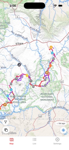
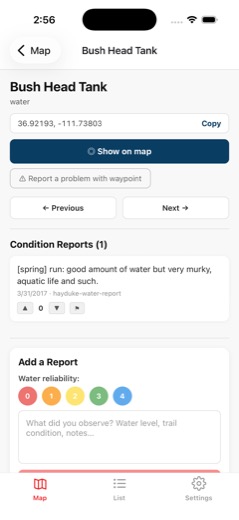
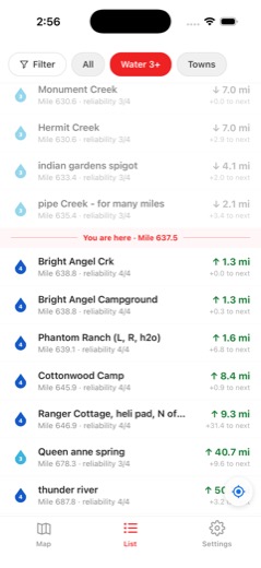
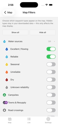
Beta software. Not stable enough to rely on for an actual hike this fall or spring season. Good for planning and exploring the route data, not a replacement for a dedicated GPS and paper maps on trail.
TestFlight Beta
Install via Apple's TestFlight. No App Store approval needed, just tap the link and install. Updates come through automatically as we push them.
Join TestFlight BetaRequires iOS 16.4+. You'll need the free TestFlight app installed first.
Google Play Testing
Android testing is through a closed Google group. Join the group first, then access the Play Store testing link to install.
Join the Google Group Play Store BetaStep 1: join the group. Step 2: install from Play Store. Both links required. Contact [email protected] with any issues.